Gary Belovsky ’72 tied flies using his dog’s hair and taught himself to cast in his suburban Chicago backyard, pretending to fish for trout in Montana’s teeming rivers. A flatlander by birth, he could see the mountains only in his mind. They exerted a gravitational pull on his imagination.
On a family vacation when he was 13, Belovsky experienced the majesty of the peaks, the immensity of the sky, the purity of the water, the sheer square mileage between himself and everybody else. Someday he would live in Montana, he declared to his parents on that trip.
He had an inheritance coming to him then, not long after his grandfather’s death, and a boy’s impulse to spend a pocketful of money. Could he put it toward as much Montana land as it could buy?
His father said no, but Gary’s interest in the place and its ecological treasures and mysteries only increased. The tale of his rebuffed real estate bid draws a nostalgic chuckle now, over dinner in Glendive, Montana, where the caravan of students he’s leading west for the summer has stopped to make camp.

On the drive out he has told a few stories about working on the National Bison Range, his research home since 1978 during teaching stints at Michigan, Utah State and now Notre Dame. Mostly, though, Gary talks about historical forces — geological, ecological, cultural — that have shaped the terrain and the people who inhabit it. Those are much older stories, and the students sometimes wonder aloud about their relevance to the grasslands and grasshoppers they signed up to study.
In character as the grouchy professor lamenting the educational fundamentals of kids today, Gary insists the lessons inform fruitful scientific research. “The students nowadays, they think their meat comes from the grocery store wrapped in cellophane,” he says. “They don’t think about the fact that we are part of the ecology — certainly were more intimately a part of the ecology in the past — and people adapt to their environments and that’s part of their culture. In fact, a lot of anthropologists would argue that it’s the most important determinant of various cultures.”
From the north woods of Michigan and Wisconsin, across the Minnesota prairie into the North Dakota badlands and through the mountain passes of Montana, he introduces the students to changing ecologies and the cultures that have lived and fought and died in them. It’s not sightseeing. It’s class.
Eight students representing schools from Arizona to Pennsylvania to Puerto Rico — including one each from Notre Dame and Saint Mary’s — will spend 10 weeks in Notre Dame’s Environmental Research Center summer program in Charlo, Montana (UNDERC-West). They were among about 30 who spent last summer in the prerequisite course at UNDERC-East on Notre Dame’s property near Land O’Lakes, Wisconsin.
UNDERC West – Images by Notre Dame Photography
The first week of the West class involves day after relentless day on the road. Seven students — the eighth, Notre Dame’s Zoe Volenec, is already in Montana preparing her research project — share two vehicles for about 1,500 miles and two tents for four nights. Most courses don’t require that kind of test.
Cliques form, patience is strained and tempers bristle from time to time, but in such a small group, shared interests tend to paper over any personality conflicts. Period music and audiobooks curated for each day provide the soundtrack and a source of occasional groaning commiseration. Field research awaits at the end of the road, and the students are anxious to get to it, but Gary doesn’t want their journey west to be wasted looking out an airplane window.
“Ecology programs tend to take somebody one place and turn them loose and say, do a study on something,” he says. “And that’s what they’re going to do, they’re getting that, but this adds something else on top of it.”
June 8: Land O’Lakes, Wisconsin, to Devils Lake, North Dakota
Early morning sunlight filters through the dense forests of sugar maple, birch, hemlock and pine, dappling the narrow Wisconsin county roads away from UNDERC-East. The way west is laid out before us, paved and interspersed with all the necessary public accommodations. Three vehicles are packed and gassed up, the students split into a van and a Ford Explorer that’s towing a trailer filled with camping gear and their suitcases stuffed for the summer.
Gary and his wife, Jennifer, an UNDERC senior research technician, lead the caravan in a University-owned Chevy Suburban with room to spare for a reporter and photographer. The Belovskys’ two dogs and three cats share the far back with the bags in a feat of luggage and animal engineering.
Lewis and Clark’s Corps of Discovery we are not.
- More Rediscovery
- Milk River
- Learning Environment
A recording of Stephen Ambrose’s book about the expedition, Undaunted Courage, comes later on the trip’s syllabus, but I know their provisions did not include travel mugs full of fresh, Keurig-brewed coffee and a package of coconut chunky Chips Ahoy! cookies.
The thought of setting off with Lewis and Clark into the wild unknown thrills Gary, but this will have to suffice. For the 10th year, he’s bound for Montana with a group of students in tow.
Bundled sage and braided sweetgrass on the dashboard serve as a traditional Native American offering for the road ahead. Sage drives away evil spirits. Sweetgrass attracts good spirits.
Its protective properties do not appear to extend to the car. About an hour into the trip, the Suburban’s speedometer stops working. The needle flops to zero in an instant. After a few teasing flutters, it flatlines for good. The odometer and cruise control go down with it.
This problem lasts only as long as it takes me to find a speedometer app on my phone. By Tuesday morning, Gary will have downloaded a voice-activated version on his smartwatch, adding a dash of Star Trek to this journey through an ancient glacier-hewn landscape.
Past Lake Superior, into the Minnesota Iron Range, U.S. 2 curls and then snaps taut-straight, like a fishing line being cast. We’re now headed to Itasca State Park and the headwaters of the Mississippi River.
The name Itasca comes from fused syllables in the middle of the Latin phrase veritas caput, which means “true head.” Explorer Henry Rowe Schoolcraft coined the word in 1832.
Whether the location was, in fact, the true head of the river remained in dispute for decades until historian, anthropologist and land surveyor Jacob V. Brower settled the question in the late 1800s. Brower also fought against logging in the pine forests, prompting the Minnesota legislature to set aside 32,690 acres as a state park in 1891.
Visitors now walk a leafy path to the spot where Lake Itasca spills over rocks to form the Mississippi River, 2,552 miles from its mouth at the Gulf of Mexico. Here it looks like a creek, maybe 15 or 20 feet wide.

Across the rocks or through water shallow enough that toddlers splash in it, the students scatter for Mississippi selfies. In what will become a recurring theme, they notice much more than most tourists.
Where I see scenery, they scan for the metadata behind the postcard views, huddling and puzzling over whatever captures their attention. What type of grass is this? What kind of insect on that leaf? That looks like a nighthawk, doesn’t it? With the white on its wings?
Bereket Mamo, a soft-spoken Augustana College student from Addis Ababa, Ethopia, stands on the riverbank shading his eyes from the sun to track dragonflies hovering overhead like a battalion of drones. One after another, the students see what he sees and tune in to the hum above them.
Angela Laws, the assistant director of UNDERC, points out their staggered formation in the air and explains that different species fly at different altitudes. This tidbit ripples through the group, spreading infectious wonder at the nuances to be found in nature, if you look closely enough.
Not far west of the park, everyone’s vision widens as the northern forests open into prairie. We’re going to the Glacial Ridge tallgrass prairie refuge in western Minnesota. Preserved only because, unlike much of the surrounding land, glacial rock deposits made it unsuitable for farming.
Agriculture, Gary explains to the group, has made tallgrass prairie the most endangered ecosystem in the United States, if not the world. The Nature Conservancy owns this patch, which in early June doesn’t yet live up to its tallgrass name. Later in the summer it will fulfill the old aphorism that you can tie the high grass around the horn of a saddle.

Gary peppers his minilecture with questions, like an improvised pop quiz: “What is the most important grass of the tallgrass prairie?”
Through several competing voices he hears the correct one. “Big bluestem, exactly.”
Fire, he continues, keeps trees from overtaking the prairie. There are controlled burns now, every few years, but it’s not a coincidence that railroad tracks run alongside this preserved prairie. Sparks from steam engines once started the occasional cleansing wildfire.
We’re feeling hot enough to catch fire ourselves as the late-afternoon sun beats down on the dry ground. With a couple hours of driving still ahead, we retreat to our vehicles’ air conditioning the rest of the way to Devils Lake.
June 9: Devils Lake to Bismarck, North Dakota
“OK, Google. Start speedometer.”
Gary enunciates that command into his watch, and we’re off on day two, past Devils Lake, on a short leg to the Fort Totten state historic site.
Legends about monsters and drowned warriors, and the unmistakable truth of the lake’s unfit-to-drink salt water, led English-speaking settlers to mistranslate the name “Spirit Water” as “Bad Spirit,” which evolved into the diabolical handle.
The internal drainage lake swells with destructive potential that could easily be taken as sinister if you’re in its path. Sprawling for 200,000 acres with hundreds of miles of shoreline, Devils Lake attracts boatloads of anglers but menaces the surrounding land.
This sunny morning on the way to Fort Totten, it looks tame and controlled, but flooded pools on the side of the road reveal the water’s toxic effects. Trees soaked in the saline have been left bone-white and barren, skeletal evidence that maybe the lake’s English name wasn’t such a misinterpretation after all.
At Fort Totten, echoes of human evil reverberate. A U.S. military post from 1867 to 1890, the fort then fell under the auspices of the government’s Bureau of Indian Affairs as a Native American boarding school. A more accurate term would have been prison.

Children, often from the tribes most hostile to the U.S. military, were taken by force, purged of their Native American identity and customs, and indoctrinated into white American culture. “It was a way of basically treating the children as hostages,” Gary says, “so that the parents wouldn’t cause trouble.”
Students were stripped of traditional dress, shorn of long hair and addressed by a Christian name. All this history is presented in sanitized museum displays, the unsettling events distant enough to render the relics comically archaic, like the dunce cap on display in the corner of a classroom.
“Can someone get a picture of me with it?” asks Judith Lakomy, a student from California University of Pennsylvania, always interested in interacting with the displays, delving deeper than simple observation.
The same is true of Jose Carlos Wharton Soto from the InterAmerican University of Puerto Rico. Jose is a musician and opera singer, endlessly curious, another reliable volunteer at the hands-on exhibits.
Later in the day at the Lewis and Clark Interpretive Center, he models a garment of obvious historic necessity but well-suited to a modern performer, too: a buffalo hide robe. A guide lays it across the floor like a rug, expertly folds a thick collar and drapes it over Jose’s shoulders. Like Meriwether Lewis or James Brown, he looks comfortable in full-length fur.
Answering the workbook questions, on the other hand, makes Jose and his classmates a little uneasy. Displays at the Lewis and Clark center offer a few clues, but they hold informal group discussions to check their work.
Gary drops in on a few of them talking about commerce in the time of Lewis and Clark.
“What is the currency of the fur trade?” he says, repeating a question verbatim from the book.
“Oh. Fur.”
“Which?” There’s a little edge in Gary’s voice, as if to say, no, the answer isn’t right there in the question.
“Buffalo.”
He shakes his head.
“Beaver.”
“Yeah.”
The students stay quiet until Gary walks out of earshot. “We’ve got to fix that,” Jose says with a laugh.
Lewis and Clark spent the winter of 1804-05 among the Native Americans near here, in what’s now Washburn, North Dakota. The area had been a vibrant community and commercial center for centuries before the United States began its quest to settle the West. Beginning in the late 1400s, the Mandan tribe lived in earth lodge villages in the Missouri River valley. Late Tuesday afternoon we stop at Double Ditch, the site of one overlooking the Missouri River near Bismarck.
An agricultural tribe, the Mandan raised corn, beans and squash for themselves and to trade with nomadic tribes in the region. The area also had abundant wildlife to hunt and cottonwood timber to build earth lodges. Each lodge, which ranged from 20 to 65 feet in diameter and housed from eight to 20 people, required 150 trees to construct.
By the late 1700s, 15,000 Mandans were living in the villages, making it a more densely populated area at the time than Philadelphia, then the largest city in the United States.
“Think about this in terms of people’s impact on the environment,” Gary says.
The earliest lodges, he notes, were rectangular and later became circular. Why? He waves away guesses about spiritual harmony and pushes the students toward the more practical answer: available resources.
“It takes less wood to make the round house to give the same area of living space,” he says. “What’s that telling you about what the people are facing? Shortage of wood.”
Housing the expanding population had taken a toll on the amount of cottonwood timber available, Gary concludes. “They had to adapt.”
Smallpox epidemics in the 1780s and again in the 1830s decimated the Mandans, killing the vast majority and dispersing the rest. The few Mandan survivors joined with their Hidatsa and Arikara neighbors to form the Three Affiliated Tribes. They have shared the Fort Berthold Reservation in western North Dakota since 1870.
Those sorrows linger in the mind, but the minor, immediate needs and discomforts of the road soon replace them. We’re hot and tired and hungry, and there’s a Space Aliens diner not far away in Bismarck that has, we’re promised, better food than the name might suggest.
Although the restaurant goes all-in on the UFO theme, dinner lives up to its billing and the students arrive at their wooded, riverside campsite at Fort Abraham Lincoln State Park in good spirits. Setting up the tents takes 10 minutes, tops, like an REI-sponsored Amish barn-raising.
Nocturnal alliances begin to form over who sleeps in which tent, based on who wants a slumber party and who wants slumber. At dusk, at peace, pleasant weather and an orange corona of sunset over the Heart River seem to promise everyone a good night.
June 10: Bismarck, North Dakota, to Glendive, Montana
A photo from 1948, on display in the visitor’s center of a traditional Mandan village, looks like a thousand others from government-signing ceremonies. It shows U.S. Secretary of the Interior J.A. Krug completing a transfer of land from native tribes for the Garrison Dam on the Missouri River. But just to Krug’s right stands George Gillette, chairman of the Three Affiliated Tribes, glasses in one hand, head in the other, face contorted in grief.
“We will sign this contract with a heavy heart,” Gillette said that day. “With a few scratches of a pen, we will sell the best part of our reservation.”
More than 150,000 acres, a quarter of the Fort Berthold Reservation, would be lost, flooded by the dam, displacing 1,700 residents, 80 percent of its population at the time.
The reconstructed On-A-Slant Village outside the center depicts how the Mandans lived for hundreds of years before the smallpox diaspora, before the move to the reservation, before the washing away of distant and recent history. The village is a re-creation of the archaeological remnants we saw yesterday at Double Ditch.
“Unless you actually see a real lodge,” Gary says, “it doesn’t click.”
Inside the circular lodge, cooking, planting and hide-tanning tools are arrayed on the floor, and a cache of corn and beans leaning against a wall shows how they stored food. They dug bell-shaped pits and buried vegetables that had been dried for better preservation on cottonwood scaffolds.
“It wasn’t all work and no play,” our guide says, pointing out the buffalo ribs fashioned into a child’s sled and the implements of a game called double-ball. Using Y-shaped willow branches they tossed the double-ball — so called, the guide coughs, because it was made from part of the male buffalo — and attempted to catch it in the crook of the stick.
Adjacent to the village is Fort Abraham Lincoln, a former U.S. Army cavalry and infantry post, including the rambling manse of its commanding officer, General George Armstrong Custer. Inside the house it’s 1875, the guide dressed in a period uniform, playing tunes of the era on a violin and guarding the modesty of “Mrs. General Custer” as the tour group passes within sight of her underclothes. Hunting, hosting socials, playing cards and billiards with officers, Custer lived here for three happy years until he rode off with the 7th Cavalry over the hills outside his kitchen door toward Little Big Horn.
We’ll get to that battlefield in Montana tomorrow, but for the rest of the day we’ll skip a little bit forward from 1875 and then a long way back in time. Douglas Brinkley’s book The Wilderness Warrior: Theodore Roosevelt and the Crusade for America introduces the group to the conservationist passions and policies of the 26th president. Our next stop will be the national park named for TR.
Arriving in this territory in 1883, a sign at the park notes, Roosevelt at age 24 was just another “dude on the frontier” hunting buffalo for the first time. Because of the political inspiration from his experience there, spectacular formations like the North Dakota badlands that we’re overlooking now remain unspoiled as national parks or forest and wildlife preserves.
Against the badlands backdrop, the students huddle for group selfies, but as usual their focus soon narrows. They’re on their knees, noses in blades of grass or bushes, ecological detectives teasing out what grows where and why. Not for the first or last time, Cinzia Ballantyne, a senior at Simmons College in Boston and a telescopic observer (and Instagrammer) of the landscape, sighs with delight about a bird: “I just saw a yellow warbler, and it was majestic.”
The majesty here has gripped us all. For the first time, there are hints of the elevation — of land and spirit — to come. This is a relatively short stop on the schedule, before riding a little farther to Roosevelt’s cottage and a prairie dog town, but the students could explore the badlands for hours.
Like he does with his alert and inclined-to-dart Gordon setters, Murphy and Abby, Gary keeps a tight leash on the students. And, like Murphy and Abby, they often tug in another direction.
The tension reflects the strange experience of time on this trip. On the road, it plods, but there’s never enough at any stop. Everyone wants to stay here longer and, at the same time, hurry up and get to the prairie dogs.
When we arrive at their wide roadside field of Whac-A-Mole holes, the fuzzy little rodents bark to warn each other of another human intrusion, but they seem mostly unperturbed. A few burrow away, but others stand erect, as if posing for photos.
Not even prairie dogs can distract this group entirely from the grass. This time Angela, the assistant director, and a couple students go looking for grasshoppers. They find leafhoppers instead, “teeny tiny” almond-shaped jumpers — “there’s one” — almost imperceptible among the blades.
“Side quests,” Sam Harrow calls these deviations from the primary purpose of a stop. The students are all inquisitive beyond the boundaries of the syllabus, and wherever we go the University of Arizona senior is constantly in search — of beauty, of knowledge, of experience.
We soon cross the Montana state line, a milestone diminished somewhat by the fact that we’re still more than 500 miles from UNDERC-West. In downtown Glendive, we pass the Beer Jug tavern — “Welcome Miss Montana” — a casino, a VFW hall and a used clothing store. Through a residential neighborhood we catch glimpses of Makoshika State Park’s badlands between the homes until, suddenly, they loom.
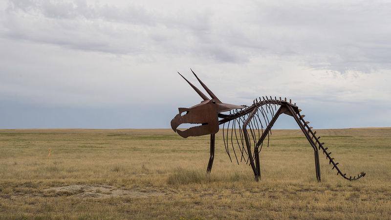
The students will camp here tonight, alongside formations revealing layers of geologic time older than the Dakota badlands, and hear from a ranger about discoveries on the site, including T-Rex and Triceratops fossils.
Now this, this is history that resonates with the aspiring ecologists. Already they’re starting to feel at home in Montana.
June 11: Glendive to Three Forks, Montana
It’s a gloomy morning on the ribbon of I-94 out of Glendive toward Pompey’s Pillar, the rock formation featuring the only surviving physical evidence of the Lewis and Clark expedition. The “W. Clark” etched into the rock on July 25, 1806, makes this spot a historical novelty, but the importance of the location long predates that early U.S. graffiti.
Around Pompey’s Pillar, sandstone cliffs extend for miles along the Yellowstone River, but at this spot there’s a natural gap where migrating buffalo and elk could cross it. Fire pits and tools offer evidence of Native American hunting camps dating back as much as 11,000 years and indicate the abundance available here.
The bounty they gathered could not have been more substantial than the staple we’re headed toward for lunch: Indian fry bread. A traditional food with debated origins, it’s a mainstay on the menu at the trading post restaurant next to Little Bighorn.
The fry bread is the size of the plate it’s served on and thick as a deep-dish pizza. A few order it topped with taco fixings, others with only honey, but either way we’re fortified for the battlefield. Or for a nap, but Custer’s Last Stand happened just across the street. So we fight on.
Of all the stops along the way, sites Gary has visited for decades, he can’t pick a favorite. “It’s all favorite,” he says. But Little Bighorn brings out the buff in him.
Piling everyone into the van except Angela and Jennifer, who stay behind with the dogs, he narrates the story of the battle that raged in these hills on the road around the battlefield. His vivid account of Custer’s doomed strategy culminates in an image of soldiers fleeing the Lakota Sioux and Northern Cheyenne in a futile retreat. “Crazy Horse’s people say it was like a buffalo hunt,” Gary says. “They’re riding alongside these guys and hitting them on the head as they’re running.”
Custer came up what’s now known as Last Stand Hill in a desperate attempt to save them, but white markers scattered on the slope show where the general and his men fell. Since 1881, five years after the battle, a memorial on the site has recognized the American soldiers’ sacrifice. Only in 2003 was a monument built to honor the Native Americans who fought and died that day.

At our next stop near Billings, Native Americans left a record that dates back millennia. Like Pompey’s Pillar, Pictograph Cave State Park sits at a gap in the Yellowstone River’s cliffs. Prehistoric tribes there survived on the migrating wildlife.
The tribes lived in and around the caves, decorating the walls with pictographs thought to commemorate important moments or to serve as prayers for extraordinary powers. Unstable overhanging rock makes Pictograph Cave itself off-limits on our visit, but as we stroll the paths near the openings, someone notices the echo of conversations and considers the acoustics. A perfect opportunity for Jose to show off his operatic training.
He’s reluctant, but the peer pressure is persistent and he climbs sheepishly onto a rock, faces a gaping cave mouth and begins to sing. His countertenor voice reverberates off the walls and engulfs the valley. Birds nesting in high boulders flutter out of the cave.
The song is called “Music for a While,” but Jose’s impromptu performance lasts only about 30 seconds before he turns toward the group with a bashful smile and crouches to hop off his rock stage. Applause and shouts of praise lead to calls for an encore. He obliges with a sampling from a personal favorite, a Peruvian waltz called “La Flor de la Canela,” or “The Flower of Cinnamon.” The sound seems to emanate from the cave mouth, amplifying one human voice to the colossal scale of the surrounding terrain. Birdsong provides accompaniment, as if they had rehearsed, giving Jose’s few brief notes a sense of unifying beauty.
Outside Pictograph, beyond Billings, the grandeur is everywhere you look. We’ll drive past sunset tonight, but right now the early evening rays cast a translucent curtain across the Crazy Mountains in the distance. Wooded inclines on the rising terrain around us are streaked in a deep green.
“Elk!” Gary calls out and I crane my neck to catch a glimpse as the car speeds past the open field.
There is almost too much to take in and diminishing daylight to see it all. Forested hills, some full and dense, some charred to scattered matchsticks. The Yellowstone River glinting on our left and then our right as we follow the winding road. Wildlife that could be anywhere. And the omnipresent mountains.
Ahead now is the Bridger Range, rising until the peaks are indistinguishable from the clouds above them, backlit by the setting sun.
June 12: Three Forks to Charlo, Montana, and UNDERC-West
On July 28, 1805, Lewis and Clark arrived at the confluence of what they named the Jefferson, Madison and Gallatin rivers — after the president and the secretaries of state and treasury — that formed the Missouri River. They were not in high spirits.
Rheumatism gnarled Clark’s joints. The snow-capped Rocky Mountains loomed to the west like an insurmountable wall between them and the Pacific. And since weathering the previous winter in North Dakota with the Mandan, who assured them they would meet Shoshone Indians farther west, they had encountered no people, no opportunity to trade for the horses they needed.
“And they were out of whiskey,” Judith says.
“And they were out of whiskey,” Gary echoes.
The students, although also without whiskey, are having a much better time. Along a trail at the Missouri Headwaters State park, Cinzia and Sean Wineland, the student with the most sensitive birdsong antenna, spot magpies in a tree, a mother feeding babies that are squawking insistently for their breakfast.
“I’ve never been happier than at this moment,” Cinzia coos. “I love baby birds. They’re so demanding.”
Nearby Gary explains the ecological richness of the region in birds and wildlife as a pelican flies overhead and diverts everyone’s attention. This was fiercely contested land among Native Americans, eventually possessed by the Blackfeet, who controlled the territory at the three forks that formed the Missouri.
“And remember, early on, what was the currency of the fur trade?” Gary asks.
“Beaver pelts,” several students answer in unison.
By the mid-19th century, another currency made the area one of the first to be settled in Montana. Gold rushers populated such Wild West towns as Nevada City and Virginia City. We wander through the kitschy history in those towns, but the last stop of the trip offers a glimpse into the past that feels more authentic.
Grant-Kohrs Ranch near Deer Lodge, Montana, re-creates what, beginning in the 1860s, was a 10-million-acre open-range cattle conglomerate. A pot of “cowboy coffee” brews over a campfire, and most of us sample a cup. As a long week draws to a close, the caffeine jolt serves us well, if not the hot viscous liquid that delivers it.
“They liked it really thick and strong and black,” the resident camp cook tells us as smoke blows off the burning embers. “They didn’t hold with any kind of milk or anything because they thought that if they started demanding milk somebody would make them milk the cows and that was not in their job description.”
Over in the barn we learn that shoeing horses is not part of Lyndel Meikle’s job description. She’s not a farrier, she says in response to a question, she’s a blacksmith, a word she knows in 73 languages, including Amharic, the official language of Ethopia, which she shows off after Bereket introduces himself.
“It’s kind of useless to say blacksmith in 73 languages,” she says, “although I like it in French, je suis un forgeron.”
Meikle works next to the radiating oven, telling historic and contemporary tales of the trade as the ping of hammer on anvil provides a percussive rhythm. She’s forging iron into a hoof pick as she speaks.
This is a 1935 farm shop, the kind of place that didn’t need someone of her skills back then. Not only because “most of the old-time blacksmiths were women, right?” she offers with a sarcastic arch of the eyebrows, but because ranchers did their own repair work. Many still do.
“A valuable enough activity today,” she says, “that this is required in the high school, in Ag 1.”
Working in this old-time shop has its advantages. The fire burns a thousand degrees hotter than a modern gas forge, allowing a skilled blacksmith to do otherwise impossible jobs, particularly the work that satisfies Meikle most. She would rather fix something, she says, than make something. “I did a five-dollar repair for a rancher whose other choice was a $900 new part. In this valley, average farm income’s $30,000, you don’t throw away $895.”
Her humility, wry humor and the virtual magic trick she performed, playing with fire and metal to make that hoof pick before our eyes in two minutes, made the final stop one of the most popular of the trip.
Sam, in particular, walks back to the van as if hypnotized, with a book recommendation about blacksmithing — Foxfire 5 — and a reorganized list of role models. “She’s my new hero.”
We’re still a couple hours away from UNDERC-West, but we all feel re-energized for the final leg, better caffeinated and educated than when we arrived at the ranch and soon within sight of our summit.
North of Missoula, the sweeping vista of the Mission Mountains rises into view over the crest of hill, like the earth itself emerging from dark space in images of the moon landing, and the trip feels complete.
“Our mountains,” Gary says.
We’re here.
June 13: Charlo, Montana, and UNDERC-West
Sipping a cup of coffee on his deck, Gary takes in the grandeur of the Mission peaks set against a cloudless blue sky.
Murphy and Abby have the run of the Belovskys’ fenced-in backyard. An adjacent bird refuge provides plenty of potential prey to occupy their attention. Fluttering in the gusty airspace overhead, the birds hover as if to tempt the dogs, then fly away unruffled.
The couple own 75 mostly open acres. Their house sits two miles as the crow flies from UNDERC-West, but it’s at least a 20-minute drive around the hill between them and where the students live.
The students arrived after dark Friday night to discover conditions Angela had warned them about. “I email them to expect mouse poop,” she says, and they find it.
The women live in a double-wide with a kitchen the width of a commuter train. Across the road, the men share a structure more like a shed. Their laundry, bathroom and closet occupy the same space. One of the beds is in the living room. Classes are held in a room the size of a porch on the back of the women’s house.
Some of the students slept in their tents Friday night to put off housecleaning until morning. In the light of day, they wonder if the tents might not make nice rooms for the whole summer. But they know better and set to work making a home.
By late Saturday morning, most of the chores are done. Dishes are clean. Laundry dries on a clothesline stretched between trees. Rodent scat has been collected and discarded. Everything scrubbed.
Unlike the comfortable, spacious dorms they had last summer at UNDERC-East, these are close, austere quarters. Personalities collide. Already a request to borrow a French press has been rebuffed. On the first morning, the thought of spending all summer here can feel like an eternity.
“But then,” Angela says, “you look around.”
Mountains like most of them have never seen cut a jagged profile across the sky, their peaks shadowed by broken clouds floating just above them. To get to the Flathead River, its water a glittering blue-green from the minerals in the glacial runoff that formed it, takes only 15 minutes on foot. Their primary laboratory will be the National Bison Range. For the summer, the students will be neighbors to the natural world, bearing witness to ecological history, tracking its future, trekking wherever their curiosity leads.
“Out here it’s like a culminating experience,” Sean says. “You get the best of everything — well, maybe not living space — but the research is going to be great and the free time.”
They have some time Saturday afternoon, and I join a group setting off toward the Flathead. We walk crackling over gravel past pastures of grazing cattle in a valley with 360-degree mountain views.
Two dogs bound out from a yard of one of the houses scattered along the road. They snuffle up to everyone in turn, as if asking their new friends to play. Saint Mary’s senior Marisa McNally sums up the prevailing mood that the setting and the canine welcoming committee create.
“Is this what heaven is like, dogs running up to greet you as you walk into the clouds?”
Jason Kelly is an associate editor of this magazine.